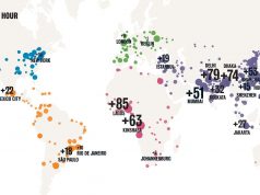
24 Hours of the New York Transit System based on the General Transit Feed Specification (GTFS)— Sumus Technology
MESH City readers may remember when our founder kicked off the TTC Challenge about five years ago. Outside of getting to collaborate with some of Toronto’s most interesting programmers, one of the outcomes of that challenge was that for a brief moment Toronto was a global leader in the Open Data movement, something that was quickly—not to mention unceremoniously—forgotten when Mayor David Miller left office to be replaced by the less than interested Rob Ford.
While political winds have changed direction locally, the international Open Data movement continues on its unwavering path. Google Inc.’s massive influence is part of the reason for this. Leaders there see markets dramatically larger than those of search alone opened up when city information becomes ubiquitous.
Google aside, one of the most compelling aspects of Open Data for MESH Cities is in the way it allows insights into the day-to-day operations of our 21st C. cities.
Canadian developer/programmer Andrew Walker of Vancouver-based Sumus Technology gives us these brilliantly illustrative examples. Effective transit is one of the cornerstones of livable cities. The more we understand the complexities of existing transit solutions, the better able we can design more efficient, less costly systems for the future. Walker’s satellite-level views offer us those insights.
“I was hoping these videos would help generate some discussion on the role of transit,” writes Andrew. Take a look at some of these city transit mappings to find out if they achieve his goal.
24 Hours of the Philadelphia Transit System from Sumus Technology
24 Hours of the Dallas Transit System from Sumus Technology:
See the complete list of Andrew’s transit videos here: http://www.youtube.com/stltransit


